Google Earth for the Mars 2020 Mission
As many of you may know, Google Earth can be switched to view Mars, becoming "Google Mars" in effect. At present, however, there is no detailed imagery of Jezero Crater available from the Google servers. Thankfully, the USGS has provided large detailed basemaps of the area where Perseverance will be roving. The files available on this page will allow this map data to be used with Google Earth.
The overview map covers an area roughly 30km square at a resolution of 6m per pixel:
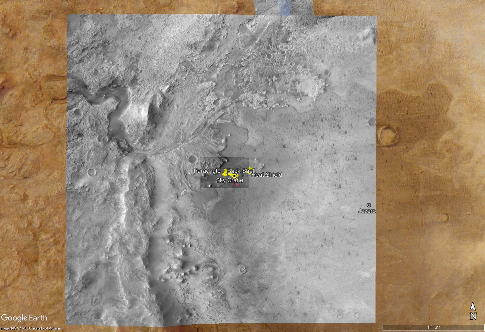
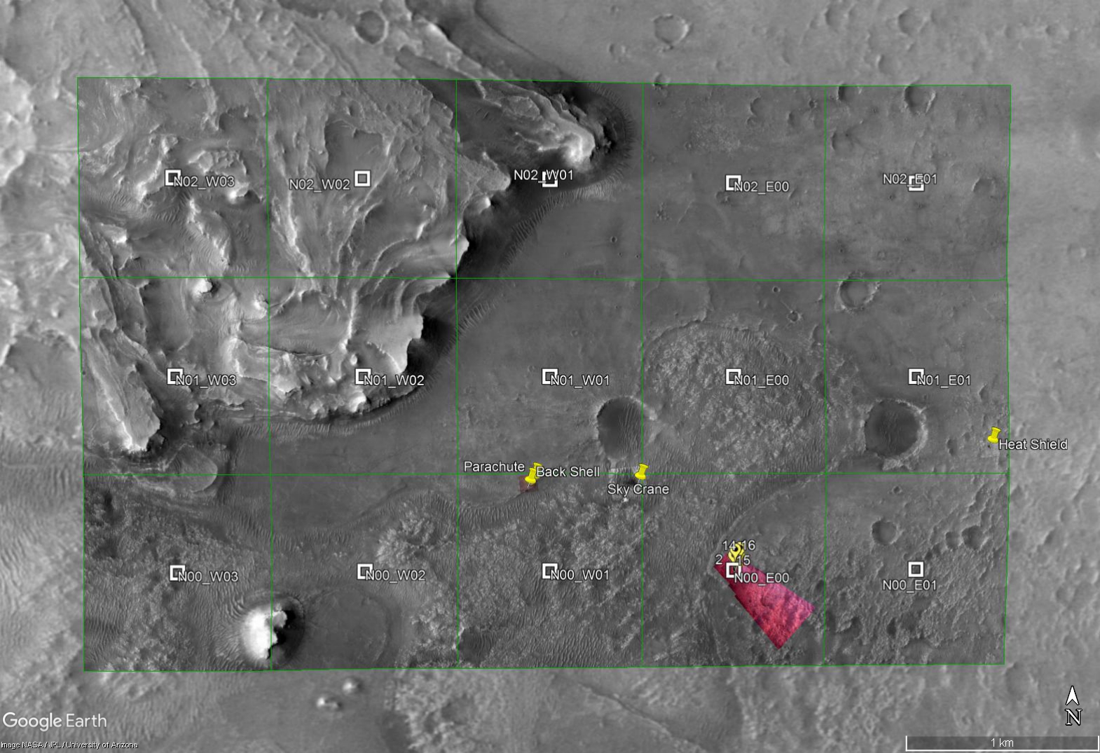
The detailed basemap has a nominal resolution of 0.25m per pixel. This map comes in at a hefty 6.9 gigabytes with over 80,000 pixels in each dimension. To make it useable with Google Earth, this large image was split into tiles of 4000x4000 pixels. Each of these tiles is about one square kilometer. Fifteen tiles are included with this release, with more to follow as the mission develops:
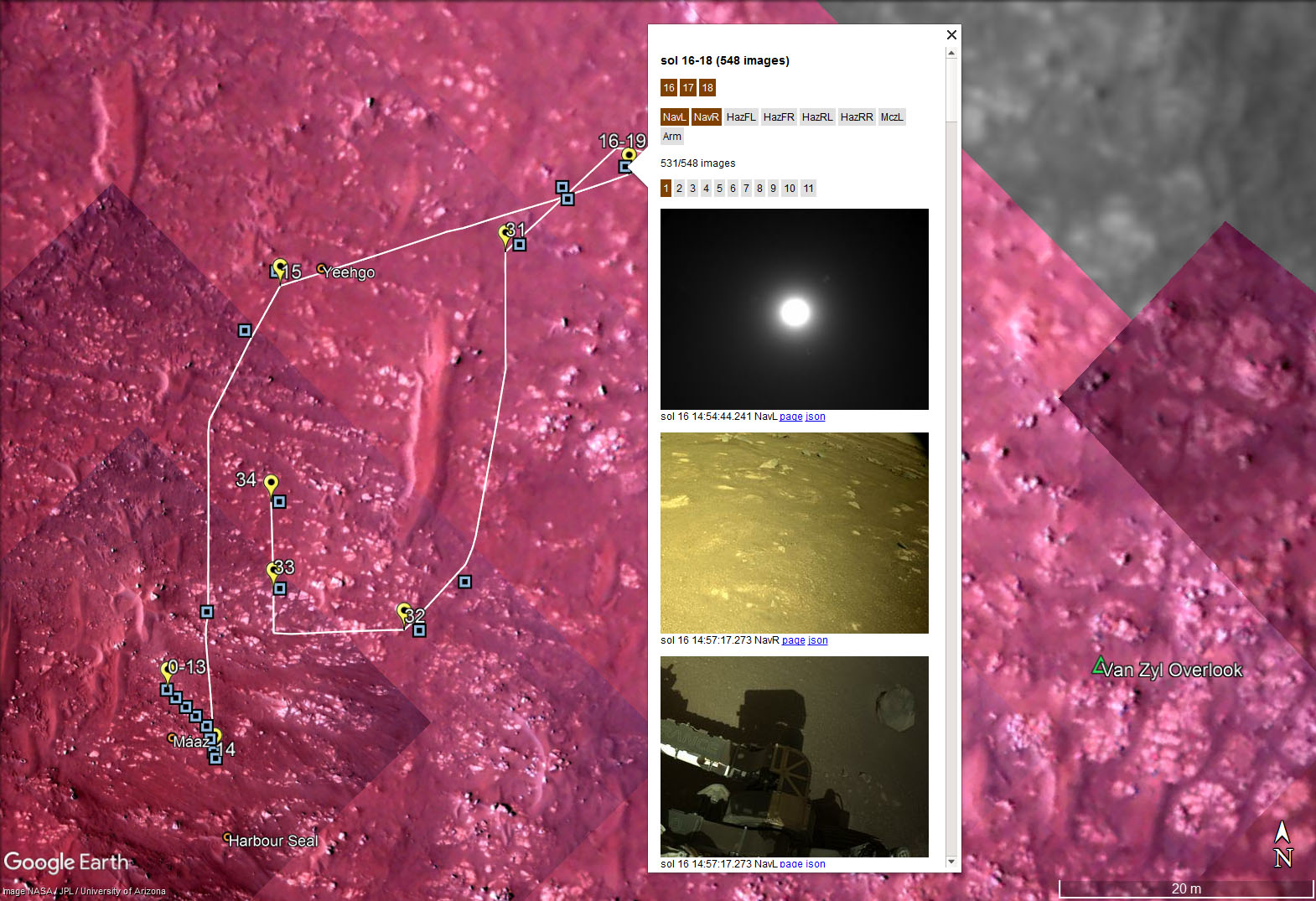
NASA web servers provide "json" data that can be used to track the movements of Perseverance. Raw images provide metadata that indicate the location where the image was taken. Combining these offers a convenient method of following Percy's journey as shown below:
Installation
The latest version of Google Earth Pro for Desktop is recommended. Version 5.0 or later is needed for the image browser. Mobile isn't currently supported.
For new users to Google Earth, the data files provided here are .kml and .kmz files. These are to Google Earth as .html files are to a web browser. Thus, they do not represent a security threat as they are not executable files.
Download mars2020.zip (51MB download) and extract the files to a suitable directory. If you prefer, individual files are available here - just be sure to maintain the directory structure before opening the mars2020.kml file. If you've previously downloaded the zip file, to get the new features you can download (not open) the mars2020.kml file and overwrite the previous version in the directory you chose before.
Open the mars2020.kml file and it will initially appear in the "Temporary Places" folder in the side panel. When you exit Google Earth, it will prompt you to save it permanently.
Updates
The track and image data are updated automatically by my server on a set schedule. While Google Earth is open it will refresh at the following intervals:
| Item | Refresh Interval | Server Updates |
|---|---|---|
| track-updater | 3 hours | At the top of the hour |
| images-updater | 3 hours | At the bottom of the hour |
| features-updater | 24 hours | Ad hoc, human generated |
Items can be manually refreshed to get the latest data by opening the item's context menu and selecting "Refresh".
Tips
These are some useful options you may want to set:
- Menu > View > Explore > Mars
- Menu > Tools > Options... > 3d View > Elevation Exaggeration = 1.0
- Menu > Tools > Options... > 3d View > Units of Measurement > Meters, Kilometers
- Menu > Tools > Options... > Navigation > Navigation > Do not automatically tilt while zooming
- Side Panel > Layers > Primary Database > Terrain = checked
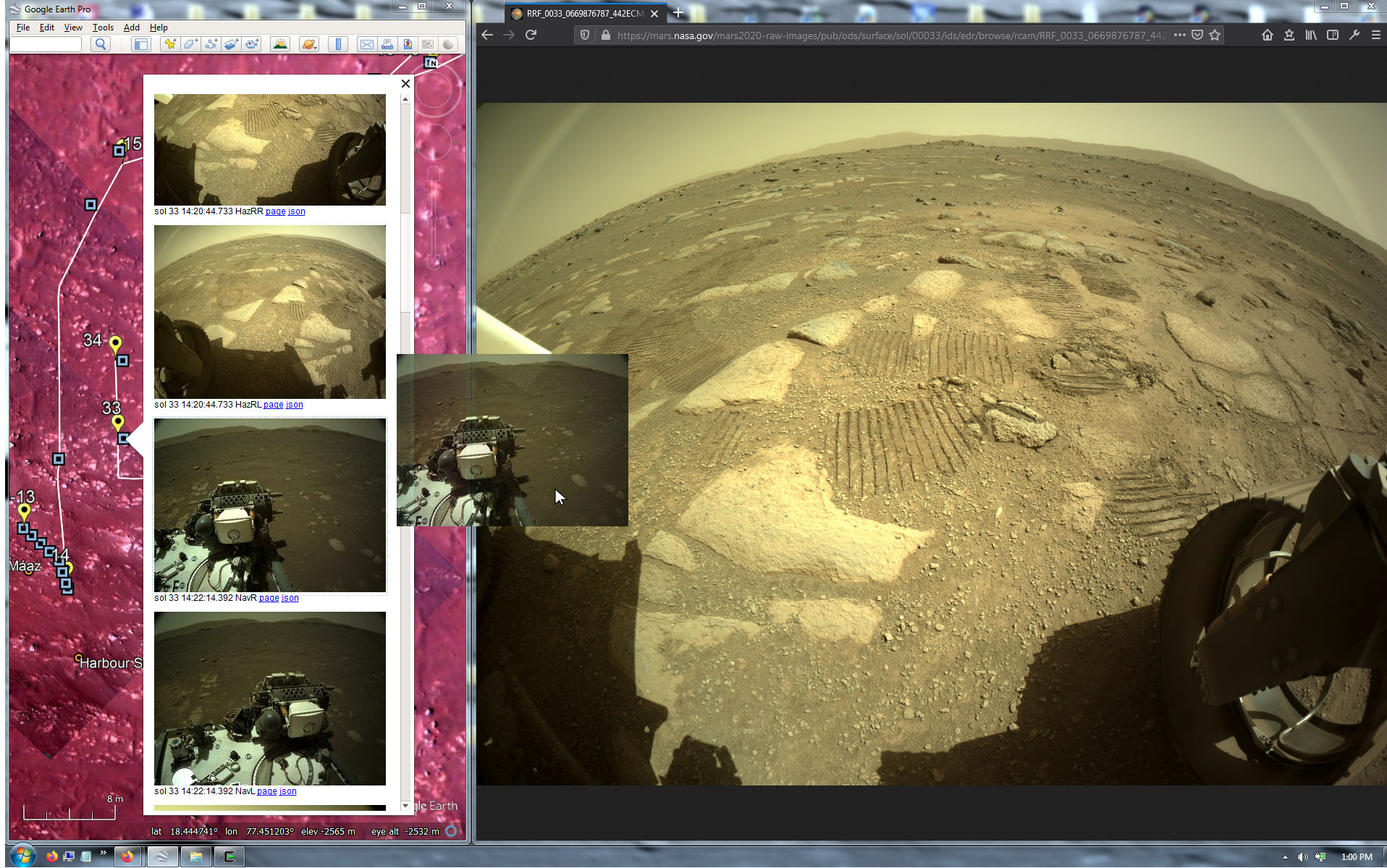
When clicking an image in the image browser popup, it opens the full-size image in a new web browser. Google Earth closes the image popup after you make a selection. This can be annoying if you're sifting through hundreds of images. One workaround is to keep a web browser open next to Google Earth, and simply drag images to the browser:
If you have any questions, comments, or bug reports please contact me via email as user "markrilg" at the ubiquitous Google email service.
© 2021 Mark Riley, All Rights Reserved.